US’s secret spy payload offloaded: Rocket Lab demos missile muscle with second Electron guided home

Small-sat flinger Rocket Lab beat the winds to get the mysterious National Reconnaissance Office (NRO) payload off the New Zealand launchpad this morning.

After multiple holds due to ground winds, the Electron lifted off at 02:56 UTC on 31 January from the company’s Launch Complex 1 on the New Zealand Mahia Peninsula.

Dubbed “Birds of a Feather”, the mission was the 11th of the company’s Electron booster. While the details of the payload were light (NRO doesn’t like talking too much about its toys), the launch represented the second time Rocket Lab attempted to steer the spent booster back to Earth.

The launch itself went nominally, with main engine cut-off occurring just after two minutes, 30 seconds. The first stage then separated and began its journey back home while the second stage ignited to send the payload to orbit. Rocket Labs’ Kick Stage was then used to shepherd the satellite to the desired orbit.

Chief exec Peter Beck is keen on recovering those first stages and, like the previous mission, the Electron was fitted with the equipment necessary to survive a return to Earth (right up until smacking into the sea).

A reaction control system on the first stage spun the booster around 180 degrees at the six minute, 30 second mark and then maintained the correct angle of attack during the descent. A minute later, the spent booster encountered what Rocket Lab calls “The Wall” as the atmosphere became denser and the rocket decelerated from supersonic to subsonic speeds.

Beck described the aerodynamic forces involved as akin to “perching three elephants atop the Electron stack” in a chat with The Register back in August last year.

As with its predecessor, the booster made it back to Earth and disintegrated upon impact with the ocean – as planned – approximately nine minutes after launch.

Those hoping for a SpaceX-style propulsive landing on legs will be disappointed. Rocket Labs’ plans will see the returning booster eventually equipped with a parachute and snatched by helicopter.

The gang will then recycle the things to augment the production lines should the launch frequency ramp up in the way Beck hopes.

Source: US’s secret spy payload offloaded: Rocket Lab demos missile muscle with second Electron guided home

NSF’s newest solar telescope produces first images, most detailed images of the sun

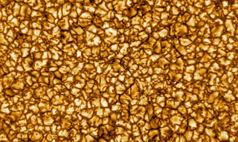
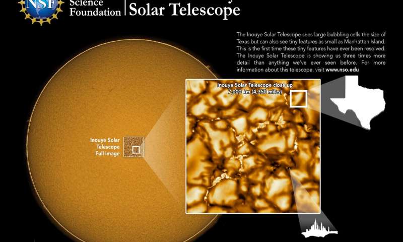
This first images from NSF’s Inouye Solar Telescope show a close-up view of the sun’s surface, which can provide important detail for scientists. The image shows a pattern of turbulent “boiling” plasma that covers the entire sun. The cell-like structures—each about the size of Texas—are the signature of violent motions that transport heat from the inside of the sun to its surface. That hot solar plasma rises in the bright centers of “cells,” cools off and then sinks below the surface in dark lanes in a process known as convection. (See video available with this news release.)

Solar magnetic fields constantly get twisted and tangled by the motions of the sun’s plasma. Twisted magnetic fields can lead to solar storms that can negatively affect our technology-dependent modern lifestyles. During 2017’s Hurricane Irma, the National Oceanic and Atmospheric Administration reported that a simultaneous space weather event brought down radio communications used by first responders, aviation and maritime channels for eight hours on the day the hurricane made landfall.

Finally resolving these tiny magnetic features is central to what makes the Inouye Solar Telescope unique. It can measure and characterize the sun’s magnetic field in more detail than ever seen before and determine the causes of potentially harmful solar activity.

“It’s all about the magnetic field,” said Thomas Rimmele, director of the Inouye Solar Telescope. “To unravel the sun’s biggest mysteries, we have to not only be able to clearly see these tiny structures from 93 million miles away but very precisely measure their strength and direction near the surface and trace the field as it extends out into the million-degree corona, the outer atmosphere of the sun.”

Better understanding the origins of potential disasters will enable governments and utilities to better prepare for inevitable future space weather events. It is expected that notification of potential impacts could occur earlier—as much as 48 hours ahead of time instead of the current standard, which is about 48 minutes. This would allow for more time to secure power grids and critical infrastructure and to put satellites into safe mode.

he Inouye Solar Telescope combines a 13-foot (4-meter) mirror—the world’s largest for a —with unparalleled viewing conditions at the 10,000-foot Haleakalā summit.

Focusing 13 kilowatts of solar power generates enormous amounts of heat—heat that must be contained or removed. A specialized cooling system provides crucial heat protection for the telescope and its optics. More than seven miles of piping distribute coolant throughout the observatory, partially chilled by ice created on site during the night.

00:00
00:00
The Daniel K. Inouye Solar Telescope has produced the highest resolution observations of the sun’s surface ever taken. In this movie, taken at a wavelength of 705 nanometers (nm) over a period of 10 minutes, we can see features as small as 30km (18 miles) in size for the first time ever. The movie shows the turbulent, Credit: NSO/AURA/NSF

The dome enclosing the telescope is covered by thin cooling plates that stabilize the temperature around the telescope, helped by shutters within the dome that provide shade and air circulation. The “heat-stop” (a high-tech, liquid-cooled metal donut) blocks most of the sunlight’s energy from the main mirror, allowing scientists to study specific regions of the sun with unparalleled clarity.

[…]

“This image is just the beginning,” said David Boboltz, program director in NSF’s division of astronomical sciences and who oversees the facility’s construction and operations. “Over the next six months, the Inouye telescope’s team of scientists, engineers and technicians will continue testing and commissioning the telescope to make it ready for use by the international solar scientific community. The Inouye Solar Telescope will collect more information about our sun during the first 5 years of its lifetime than all the solar data gathered since Galileo first pointed a telescope at the sun in 1612.”

Source: NSF’s newest solar telescope produces first images, most detailed images of the sun

NASA to launch projectile (DART) to see if it can deflect asteroids

DART is a planetary defense-driven test of technologies for preventing an impact of Earth by a hazardous asteroid.  DART will be the first demonstration of the kinetic impactor technique to change the motion of an asteroid in space.  The DART mission is in Phase C, led by APL and managed under NASA’s Solar System Exploration Program at Marshall Space Flight Center for NASA’s Planetary Defense Coordination Office and the Science Mission Directorate’s Planetary Science Division at NASA Headquarters in Washington, DC.

DART Spacecraft Bus
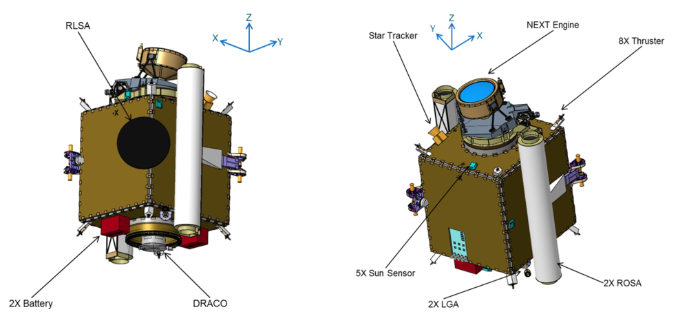
Two different views of the DART spacecraft. The DRACO (Didymos Reconnaissance & Asteroid Camera for OpNav) imaging instrument is based on the LORRI high-resolution imager from New Horizons. The left view also shows the Radial Line Slot Array (RLSA) antenna with the ROSAs (Roll-Out Solar Arrays) rolled up. The view on the right shows a clearer view of the NEXT-C ion engine.

The binary near-Earth asteroid (65803) Didymos is the target for the DART demonstration. While the Didymos primary body is approximately 780 meters across, its secondary body (or “moonlet”) is about 160-meters in size, which is more typical of the size of asteroids that could pose the most likely significant threat to Earth. The Didymos binary is being intensely observed using telescopes on Earth to precisely measure its properties before DART arrives.

Didymos and its moonlet
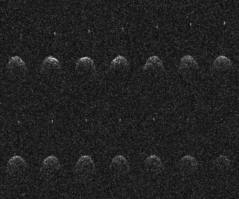
Fourteen sequential Arecibo radar images of the near-Earth asteroid (65803) Didymos and its moonlet, taken on 23, 24 and 26 November 2003. NASA’s planetary radar capabilities enable scientists to resolve shape, concavities, and possible large boulders on the surfaces of these small worlds. Photometric lightcurve data indicated that Didymos is a binary system, and radar imagery distinctly shows the secondary body.
Didymos system
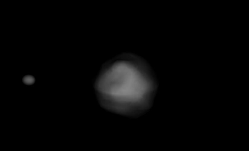
Simulated image of the Didymos system, derived from photometric lightcurve and radar data. The primary body is about 780 meters in diameter and the moonlet is approximately 160 meters in size. They are separated by just over a kilometer. The primary body rotates once every 2.26 hours while the tidally locked moonlet revolves about the primary once every 11.9 hours. Almost one sixth of the known near-Earth asteroid (NEA) population are binary or multiple-body systems.
Credits: Naidu et al., AIDA Workshop, 2016
DART spacecraft with the Roll Out Solar Arrays (rOSA)
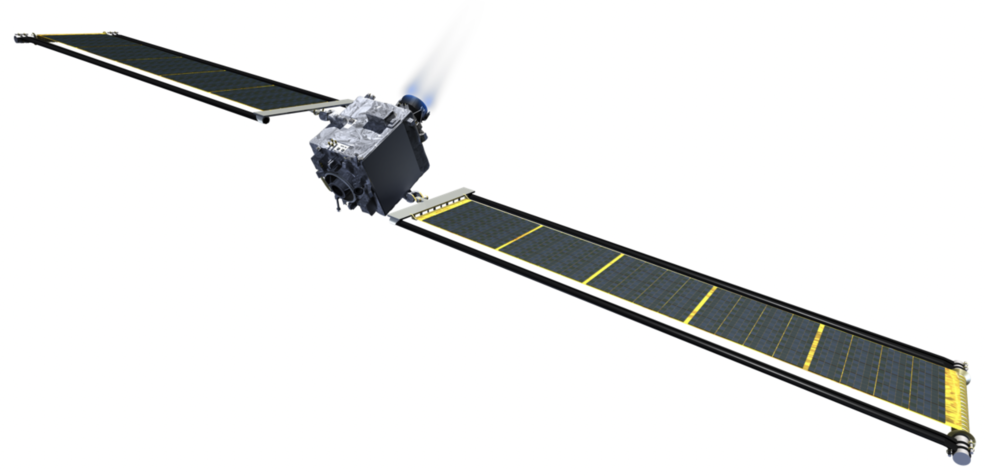
Illustration of the DART spacecraft with the Roll Out Solar Arrays (ROSA) extended. Each of the two ROSA arrays in 8.6 meters by 2.3 meters.

The DART spacecraft will achieve the kinetic impact deflection by deliberately crashing itself into the moonlet at a speed of approximately 6.6 km/s, with the aid of an onboard camera (named DRACO) and sophisticated autonomous navigation software. The collision will change the speed of the moonlet in its orbit around the main body by a fraction of one percent, but this will change the orbital period of the moonlet by several minutes – enough to be observed and measured using telescopes on Earth.

Once launched, DART will deploy Roll Out Solar Arrays (ROSA) to provide the solar power needed for DART’s electric propulsion system.  The DART spacecraft will demonstrate the NASA Evolutionary Xenon Thruster – Commercial (NEXT-C) solar electric propulsion system as part of its in-space propulsion.  NEXT-C is a next-generation system based on the Dawn spacecraft propulsion system, and was developed at NASA’s Glenn Research Center in Cleveland, Ohio.  By utilizing electric propulsion, DART could benefit from significant flexibility to the mission timeline while demonstrating the next generation of ion engine technology, with applications to potential future NASA missions.

the ROSA array on the ISS
The ROSA array was tested on board the International Space Station (ISS) in June 2017.

Once launched, DART will deploy Roll Out Solar Arrays (ROSA) to provide the solar power needed for DART’s electric propulsion system.  The DART spacecraft will demonstrate the NASA Evolutionary Xenon Thruster – Commercial (NEXT-C)solar electric propulsion system as part of its in-space propulsion.  NEXT-C is a next-generation system based on the Dawn spacecraft propulsion system, and was developed at NASA’s Glenn Research Center in Cleveland, Ohio.  By utilizing electric propulsion, DART could benefit from significant flexibility to the mission timeline while demonstrating the next generation of ion engine technology, with applications to potential future NASA missions.

The DART spacecraft launch window begins in late July 2021.  DART will launch aboard a SpaceX Falcon 9 rocket from Vandenberg Air Force Base, California. After separation from the launch vehicle and over a year of cruise it will intercept Didymos’ moonlet in late September 2022, when the Didymos system is within 11 million kilometers of Earth, enabling observations by ground-based telescopes and planetary radar to measure the change in momentum imparted to the moonlet.

Source: Double Asteroid Redirection Test (DART) Mission | NASA

Extraterrestrial ribose and other sugars found in primitive meteorites

Ribose is an essential sugar for present life as a building block of RNA, which could have both stored information and catalyzed reactions in primitive life on Earth. Meteorites contain a number of organic compounds including components of proteins and nucleic acids. Among the constituent molecular classes of proteins and nucleic acids (i.e., amino acids, nucleobases, phosphate, and ribose/deoxyribose), the presence of ribose and deoxyribose in space remains unclear. Here we provide evidence of extraterrestrial ribose and other bioessential sugars in primitive meteorites. Meteorites were carriers of prebiotic organic molecules to the early Earth; thus, the detection of extraterrestrial sugars in meteorites implies the possibility that extraterrestrial sugars may have contributed to forming functional biopolymers like RNA.

Source: Extraterrestrial ribose and other sugars in primitive meteorites | PNAS

Elon Musk’s Starlink Satellites Are Already Causing a Headache for Astronomers

Astronomers at a Chilean observatory were rudely interrupted earlier this week when a SpaceX satellite train consisting of 60 Starlink satellites drifted overhead, in what scientists are apparently going to have to accept as the new normal.

Launched into orbit on November 11, the Starlink smallsat train took five minutes to pass over the Cerro Tololo Inter-American Observatory in Chile, according to a tweet from astronomer Clarae Martínez-Vázquez.

“Wow!! I am in shock!!,” tweeted Martínez-Vázquez. “The huge amount of Starlink satellites crossed our skies tonight at [Cerro Tololo]. Our DECam [Dark Energy Camera] exposure was heavily affected by 19 of them!,” to which she added: “Rather depressing… This is not cool!”

Responding to this tweet, astronomer Cliff Johnson, a team member and a CIERA Postdoc Fellow in Astronomy at Northwestern, tweeted out a view of the disrupted data, showing an array of satellite trails strewn across an image of space.

The astronomers were collecting data using the DECam instrument, a high-performance, wide-field imager on the CTIO Blanco 4-meter telescope, as part of the DELVE survey, which is currently mapping the outer fringes of the Large and Small Magellanic Clouds as well as a significant fraction of the southern sky at optical wavelengths. Key goals of the project are to study the stellar halo around the Magellanic Clouds and detect new dwarf galaxies in orbit around the Clouds or the nearby Milky Way.

The Starlink-tarnished DECam frame, showing satellite trails across the field of view.
Image: Clara Martínez-Vázquez, Cliff Johnson, CTIO/AURA/NSF

But this research was punctuated as the Starlink train passed overhead during the early morning of Monday, November 18.

Source: Elon Musk’s Starlink Satellites Are Already Causing a Headache for Astronomers

SpaceX Starship Mk1 explodes during cryogenic loading test

SpaceX’s first full-scale Starship prototype – Mk1 – has experienced a failure at its Boca Chica test site in southern Texas. The failure occurred late in the afternoon on Wednesday, midway through a test of the vehicle’s propellant tanks.

As of a few weeks ago, the Mk1 Starship – which was shown off to the world in September as part of SpaceX’s and Elon Musk’s presentation of the design changes to the Starship system – was to fly the first 20 km test flight of the program in the coming weeks.

The main event of today, the Mk1 Starship’s first cryogenic loading test, involved filling the methane and oxygen tanks with a cryogenic liquid.

During the test, the top bulkhead of the vehicle ruptured and was ejected away from the site, followed by a large cloud of vapors and cryogenic liquid from the tank.

The cryogenic liquid – likely liquid oxygen or liquid nitrogen – was carried by the wind and dispersed over the launch complex.

The top bulkhead was seen landing nearby, but its precise location is unknown.

The bottom tank bulkhead appeared to fail as well. A second cloud of vapor appeared out of the base of the vehicle at the same time that the top ruptured – signaling that the entire internal tank structure may have failed.

Source: SpaceX Starship Mk1 fails during cryogenic loading test – NASASpaceFlight.com

Elon Musk is fine with it though. I’m glad I’m not sitting in it!

China now launches more rockets than anyone in the world: Russia 2nd, US 3rd

In recent weeks, China’s space program has made news by revealing some of its long-term ambitions for spaceflight. These include establishing an Earth-Moon space economic zone by 2050, which, if successful, could allow the country to begin to dictate the rules of behavior for future space exploration.

Some have questioned whether China, which has flown six human spaceflights in the last 16 years, can really build a large low-Earth space station, send taikonauts to the Moon, return samples from Mars, and more in the coming decade or two. But what seems clear is that the country’s authoritarian government has long-term plans and is taking steps toward becoming a global leader in space exploration.

By one important metric—orbital launches—China has already reached this goal.

In 2018, the country set a goal of 35 orbital launches and ended up with 39 launch attempts. That year, the United States (29 flights) and Russia (20) trailed China, according to Space Launch Report. It marked the first time China led the world in the number of successful orbital launches.

This year, China is set to pace the world again. Through Sunday, the country has launched 27 orbital missions, followed by Russia (19), and the United States (16). Although nearly a month and a half remain in this year, a maximum of six additional orbital launches are likely from the United States in 2019.

Source: China now launches more rockets than anyone in the world | Ars Technica

EU beurocracy, One man’s mistake, missing backups and complete reboot: What we can figure out about Europe’s Galileo satellites going dark

While one key official has sought to blame a single individual for the system going dark, insiders warn that organizational chaos, excessive secrecy and some unusual self-regulation is as much to blame.

Combined with those problems, a battle between European organizations over the satellite system, and a delayed independent report into the July cock-up, means things aren’t looking good for Europe’s answer to America’s GPS system. A much needed shake-up may be on its way.

In mid-July, the agency in charge of the network of 26 satellites, the European Global Navigation Satellite Systems Agency (EGSA), warned of a “service degradation” but assured everyone that it would quickly be resolved.

It wasn’t resolved however, and six days later the system was not only still down but getting increasingly inaccurate, with satellites reporting that they were in completely different positions in orbit than they were supposed to be – a big problem for a system whose entire purpose is to provide state-of-the-art positional accuracy to within 20 centimeters.

Billions of organizations, individuals, phones, apps and so on from across the globe simply stopped listening to Galileo. It’s hard to imagine a bigger mess, aside from the satellites crashing down to Earth.

But despite the outage and widespread criticism over the failure of those behind Galileo to explain what was going on and why, there has been almost no information from the various space agencies and organizations involved in the project.

Source: One man’s mistake, missing backups and complete reboot: The tale of Europe’s Galileo satellites going dark • The Register

The rest is in the article itself

The ‘Three-Body Problem’ Has Perplexed Astronomers Since Newton Formulated It. A.I. Just Cracked It in Under a Second.

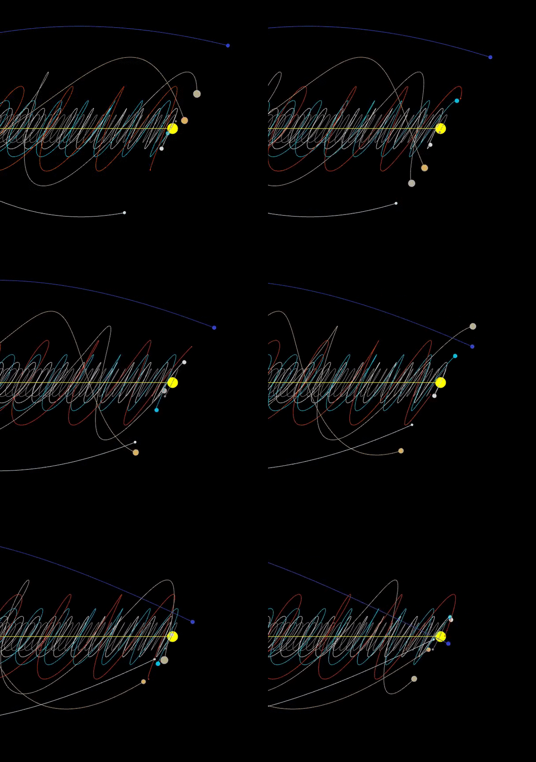
The mind-bending calculations required to predict how three heavenly bodies orbit each other have baffled physicists since the time of Sir Isaac Newton. Now artificial intelligence (A.I.) has shown that it can solve the problem in a fraction of the time required by previous approaches.

Newton was the first to formulate the problem in the 17th century, but finding a simple way to solve it has proved incredibly difficult. The gravitational interactions between three celestial objects like planets, stars and moons result in a chaotic system — one that is complex and highly sensitive to the starting positions of each body.

[…]

The algorithm they built provided accurate solutions up to 100 million times faster than the most advanced software program, known as Brutus.

[…]

Neural networks must be trained by being fed data before they can make predictions. So the researchers had to generate 9,900 simplified three-body scenarios using Brutus, the current leader when it comes to solving three-body problems.

They then tested how well the neural net could predict the evolution of 5,000 unseen scenarios, and found its results closely matched those of Brutus. However, the A.I.-based program solved the problems in an average of just a fraction of a second, compared with nearly 2 minutes.

The reason programs like Brutus are so slow is that they solve the problem by brute force, said Foley, carrying out calculations for each tiny step of the celestial bodies’ trajectories. The neural net, on the other hand, simply looks at the movements those calculations produce and deduces a pattern that can help predict how future scenarios will play out.

That presents a problem for scaling the system up, though, Foley said. The current algorithm is a proof-of-concept and learned from simplified scenarios, but training on more complex ones or even increasing the number of bodies involved to four of five first requires you to generate the data on Brutus, which can be extremely time-consuming and expensive.

Source: The ‘Three-Body Problem’ Has Perplexed Astronomers Since Newton Formulated It. A.I. Just Cracked It in Under a Second. | Live Science

Saturn surpasses Jupiter after the discovery of 20 new moons and you can help name them!

A team led by Carnegie’s Scott S. Sheppard has found 20 new moons orbiting Saturn.  This brings the ringed planet’s total number of moons to 82, surpassing Jupiter, which has 79. The discovery was announced Monday by the International Astronomical Union’s Minor Planet Center.

Each of the newly discovered moons is about five kilometers, or three miles, in diameter. Seventeen of them orbit the planet backwards, or in a retrograde direction, meaning their movement is opposite of the planet’s rotation around its axis. The other three moons orbit in the prograde—the same direction as Saturn rotates.

Two of the prograde moons are closer to the planet and take about two years to travel once around Saturn. The more-distant retrograde moons and one of the prograde moons each take more than three years to complete an orbit.

Source: Saturn surpasses Jupiter after the discovery of 20 new moons and you can help name them! | Carnegie Institution for Science

Scientists Uncover New Organic Molecules Coming Off Saturn’s Moon Enceladus

Scientists have discovered nitrogen- and oxygen- containing organic molecules in ice grains blown out by Saturn’s moon Enceladus, according to a new study.

Gas giants Saturn and Jupiter are orbited by some moons that almost seem more like planets themselves. One such moon is Saturn’s Enceladus, an icy orb thought to contain a very deep subsurface water ocean beneath a thick icy crust. Finding organic molecules on Enceladus is exciting, since water plus energy plus organic molecules might be the ingredients for life.

Enceladus blasted the material out in plumes from cracks in its south polar crust. The plumes carry a mixture of material from the moon’s rocky core and subsurface ocean. The Cassini mission flew through these plumes in 2004 and 2008, gathering data on the material with two of its instruments, the Ion and Neutral Mass Spectrometer (INMS) and the Cosmic Dust Analyser (CDA). For the new study, researchers based in Germany and the United States took a deeper look at the CDA’s data and found new organic compounds, according to the paper published in the Monthly Notices of the Royal Astronomical Society.

The molecules included amines, which are nitrogen- and oxygen-containing organic molecules similar to those on Earth that turn into amino acids. As a reminder, “organic” in this case simply means “containing carbon,” though these are the kind of compounds that can produce the complex molecules found in life on Earth.

[…]

Scientists have previously reported finding large organic molecules in Cassini data. This paper presents a new kind of molecule, one of interest to those hunting for life.

Source: Scientists Uncover New Organic Molecules Coming Off Saturn’s Moon Enceladus

A Moon Space Elevator Is Actually Feasible and Inexpensive: Study

In a paper published on the online research archive arXiv in August, Columbia astronomy students Zephyr Penoyre and Emily Sandford proposed the idea of a “lunar space elevator,” which is exactly what it sounds like—a very long elevator connecting the moon and our planet.

The concept of a moon elevator isn’t new. In the 1970s, similar ideas were floated in science fiction (Arthur C. Clarke’s The Fountains of Paradise, for example) and by academics like Jerome Pearson and Yuri Artsutanov.

But the Columbia study differs from previous proposal in an important way: instead of building the elevator from the Earth’s surface (which is impossible with today’s technology), it would be anchored on the moon and stretch some 200,000 miles toward Earth until hitting the geostationary orbit height (about 22,236 miles above sea level), at which objects move around Earth in lockstep with the planet’s own rotation.

Dangling the space elevator at this height would eliminate the need to place a large counterweight near Earth’s orbit to balance out the planet’s massive gravitational pull if the elevator were to be built from ground up. This method would also prevent any relative motion between Earth’s surface and space below the geostationary orbit area from bending or twisting the elevator.

These won’t be problems for the moon because the lunar gravitational pull is significantly smaller and the moon’s orbit is tidally locked, meaning that the moon keeps the same face turned toward Earth during its orbit, therefore no relative motion of the anchor point.

After doing the math, the researchers estimated that the simplest version of the lunar elevator would be a cable thinner than a pencil and weigh about 88,000 pounds, which is within the payload capacity of the next-generation NASA or SpaceX rocket.

The whole project may cost a few billion dollars, which is “within the whim of one particularly motivated billionaire,” said Penoyre.

Future moon travelers will still have to ride a rocket, though, to fly up to the elevator’s dangling point, and then transfer to a robotic vehicle, which would climb up the cable all the way up to the moon.

Source: A Moon Space Elevator Is Actually Feasible and Inexpensive: Study | Observer

SpaceX Says a ‘Bug’ Prevented It From Receiving Warning of Possible ESA Satellite Collision. For the first time ESA had to unexpectedly avoid a satellite constellation.

The European Space Agency was forced to perform a “collision avoidance maneuver” to prevent its Aeolus spacecraft from potentially smashing into one of Elon Musk’s Starlink satellites, in what is quickly becoming an all-too-common occurrence. According to SpaceX, it never received the expected alert that a collision was possible.

ESA pumped out a series of tweets yesterday describing the incident, in which the Aeolus satellite “fired its thrusters, moving it off a collision course with a @SpaceX satellite in their #Starlink constellation” on Monday morning. Launched in August 2018, the Aeolus Earth science satellite monitors the planet’s wind from space, allowing for better weather predictions and climate modeling.

[…]

Experts in the ESA’s Space Debris Team “calculated the risk of collision between these two active satellites,” determining that the safest option for Aeolus was to increase its height and have it pass over the SpaceX satellite, according to an ESA tweet. It marked the first time the ESA had to perform “a collision avoidance manoeuvre’ to protect one of its satellites from colliding with a ‘mega constellation,’” noted the space agency.

[…]

But as the ESA tweeted yesterday, as “the number of satellites in orbit increases, due to ‘mega constellations’ such as #Starlink comprising hundreds or even thousands of satellites, today’s ‘manual’ collision avoidance process will become impossible…”

[…]

An ESA graphic identified the culprit as being Starlink 44. The maneuver was done a half-Earth-orbit before Aeolus’ closest approach to the Starlink satellite. Jeff Foust from SpaceNews provides more insight into the incident:

Holger Krag, director of ESA’s Space Safety Programme Office, said in a Sept. 3 email that the agency’s conjunction assessment team noticed the potential close approach about five days in advance, using data provided by the U.S. Air Force’s 18th Space Control Squadron. “We have informed SpaceX and they acknowledged,” he said. “Over the days the collision probability exceeded the decision threshold and we started the maneuver preparation and shared our plans with SpaceX. The decision to maneuver was then made the day before.”

The odds of a collision were calculated at 1 in 1,000, which was high enough to warrant the maneuver. ESA scientists assessed the threat using data gathered by the U.S. Air Force, along with the “operators’ own knowledge of spacecraft positions,” according to SpaceNews.

In a statement emailed to Gizmodo, a SpaceX spokesperson said the Starlink team “last exchanged an email with the Aeolus operations team on August 28, when the probability of collision was only in the [1 in 50,000 range], well below the [1 in 10,000] industry standard threshold and 75 times lower than the final estimate.”

Once the U.S. Air Force’s updates showed that the probability had increased to more than 1 in 10,000, “a bug in our on-call paging system prevented the Starlink operator from seeing the follow on correspondence on this probability increase,” according to the spokesperson, who said “SpaceX is still investigating the issue and will implement corrective actions…. had the Starlink operator seen the correspondence, we would have coordinated with ESA to determine best approach with their continuing with their maneuver or our performing a maneuver.”

Yikes. This incident reveals the flimsy and primitive state of space traffic management, in which a failed communication led to ESA having to act unilaterally on the issue.

Source: SpaceX Says a ‘Bug’ Prevented It From Receiving Warning of Possible Satellite Collision

Well done, Elon Musk, incompetence does it again.

ESA satellite dodges a “mega constellation” – Musks cluster satellites

The European Space Agency (ESA) accomplished a first today: moving one of its satellites away from a potential collision with a “mega constellation”.

The constellation in question was SpaceX’s Starlink, and the firing of the thrusters of the Aeolus Earth observation satellite was designed to raise the orbit of the spacecraft to allow SpaceX’s satellite to pass beneath without risking a space slam.

The ESA operations team confirmed that this morning’s manoeuvre took place approximately half an orbit before the potential pileup. It also warned that, with further Starlink satellites in the pipeline and other constellations from the likes of Amazon due to launch, performing such moves manually would soon become impossible.

If plans to orbit thousands more satellites (to bring broadband to remote areas, or inflict it on air-travellers, for example) come to fruition, the ESA team reckons that things will need to be a lot more automated. Acronyms such as AI have been bandied around to create debris and constellation avoidance systems that move faster than the current human-based approach.

We contacted SpaceX to get its take on ESA’s antics, but nothing has yet emerged from Musk’s media orifice. If it does, we will update this article accordingly.

While this is a first for a “mega constellation”, ESA is well practiced at dodging satellites, although mostly dead ones (or debris.) In 2018, the boffins keeping track of things had to perform 28 manoeuvres. A swerve to miss an active spacecraft is, however, unusual.

Aeolus itself was launched on 22 August 2018, and is designed to acquire profiles of the Earth’s winds, handy for understanding the dynamics of weather and improving forecasting.

You can make your own joke about nervous squeaks of flatulence as scientists realised that the spacecraft, designed to spend just over three years in orbit, was headed toward a possible mash-up with one of Musk’s finest.

The incident serves as a timely reminder of the risks of flinging up thousands of small satellites to blanket the Earth with all manner of services. Keeping the things out of the way of each other and those spacecraft with more scientific goals will be an ever increasing challenge if the plans of Musk et al become a reality.

Source: Everyone remembers their first time: ESA satellite dodges a “mega constellation” • The Register

Mysterious, Ancient Radio Signals Keep Pelting Earth. Astronomers Designed an AI to Hunt Them Down..

Sudden shrieks of radio waves from deep space keep slamming into radio telescopes on Earth, spattering those instruments’ detectors with confusing data. And now, astronomers are using artificial intelligence to pinpoint the source of the shrieks, in the hope of explaining what’s sending them to Earth from — researchers suspect — billions of light-years across space.

Usually, these weird, unexplained signals are detected only after the fact, when astronomers notice out-of-place spikes in their data — sometimes years after the incident. The signals have complex, mysterious structures, patterns of peaks and valleys in radio waves that play out in just milliseconds. That’s not the sort of signal astronomers expect to come from a simple explosion, or any other one of the standard events known to scatter spikes of electromagnetic energy across space. Astronomers call these strange signals fast radio bursts (FRBs). Ever since the first one was uncovered in 2007, using data recorded in 2001, there’s been an ongoing effort to pin down their source. But FRBs arrive at random times and places, and existing human technology and observation methods aren’t well-primed to spot these signals.

Now, in a paper published July 4 in the journal Monthly Notices of the Royal Astronomical Society, a team of astronomers wrote that they managed to detect five FRBs in real time using a single radio telescope. [The 12 Strangest Objects in the Universe]

Wael Farah, a doctoral student at Swinburne University of Technology in Melbourne, Australia, developed a machine-learning system that recognized the signatures of FRBs as they arrived at the University of Sydney’s Molonglo Radio Observatory, near Canberra. As Live Science has previously reported, many scientific instruments, including radio telescopes, produce more data per second than they can reasonably store. So they don’t record anything in the finest detail except their most interesting observations.

Farah’s system trained the Molonglo telescope to spot FRBs and switch over to its most detailed recording mode, producing the finest records of FRBs yet.

Based on their data, the researchers predicted that between 59 and 157 theoretically detectable FRBs splash across our skies every day. The scientists also used the immediate detections to hunt for related flares in data from X-ray, optical and other radio telescopes — in hopes of finding some visible event linked to the FRBs — but had no luck.

Their research showed, however, that one of the most peculiar (and frustrating, for research purposes) traits of FRBs appears to be real: The signals, once arriving, never repeat themselves. Each one appears to be a singular event in space that will never happen again.

Source: Mysterious, Ancient Radio Signals Keep Pelting Earth. Astronomers Designed an AI to Hunt Them Down. | Live Science

Another Study Finds Our Galaxy Is ‘Warped and Twisted’

A team of Polish astronomers has created the most accurate three-dimensional map of the Milky Way to date, revealing surprising distortions and irregularities along the galactic disk.

Building an accurate map of the Milky Way is not easy.

Our location deep inside the gigantic structure means we can’t observe our galaxy externally, forcing us to envision its form from within. Dense expanses of stars, gas, and dust complicate our view even further. Despite these limitations, we know that the Milky Way is a spiral galaxy measuring around 120,000 light-years across, and that we’re located around 27,000 light-years from the galactic core.

[…]

team of scientists from the Astronomical Observatory at the University of Warsaw has compiled the most accurate 3D map of the Milky Way to date. Astronomer Dorota Skowron led the study, which was published today in Science.

Animation showing the twisted shape of our galaxy.
GIF: J. Skowron/OGLE/Astronomical Observatory, University of Warsaw/Gizmodo

Among several other new findings, the updated 3D map shows the S-shaped structure of our galaxy’s distorted stellar disk. The Milky Way is not flat like a pancake, and is instead “warped and twisted,” in the words of co-author Przemek Mroz, who described his team’s work in a related video. That our galaxy is warped was already known, but the new research further characterizes the surprising extent of these distortions. As the new research shows, this warp starts at ranges greater than 25,000 light-years from the galactic core, and it gets more severe with distance.

[…]

The new research also showed that the thickness of the Milky Way is variable throughout. Our galaxy gets thicker with distance from the core. At our location, for example, the galactic disk is about 500 light-years thick, but at the outer edges it’s as much as 3,000 light-years thick.

Milky Way Cepheids on the Milky Way map.
Image: J. Skowron/Serge Brunier

To create the 3D map, Skowron and her colleagues charted the location of Cepheid variable stars. These young, pulsating supergiants are ideal for this research because their brightness changes in a very regular pattern. Ultimately, the location of Cepheid stars within the Milky Way can be more accurately pinned down than other kinds of stars, which is precisely what was needed for this mapping project.

A sample of over 2,400 Cepheids was used to create the new map, the majority of which were identified with the Optical Gravitational Lensing Experiment (OGLE) survey, which monitors the brightness of nearly 2 billion stars. In total, the researchers observed the galactic disk for six years, taking 206,726 images of the sky.

[…]

If this work sounds familiar, it’s because research published earlier this year in Nature Astronomy employed a similar technique, in which scientists from the Chinese Academy of Sciences reached similar conclusions, using a different group of Cepheids for their map. One of the scientists behind the previous research, Xiaodian Chen from the National Astronomical Observatories at the Chinese Academy of Sciences, took issue with the fact that the authors of the new paper did not cite his team’s work. Nonetheless, he still liked the new science.

Source: Another Study Finds Our Galaxy Is ‘Warped and Twisted’

LightSail 2 Spacecraft Successfully Demonstrates Flight by Light

Since unfurling the spacecraft’s silver solar sail last week, mission managers have been optimizing the way the spacecraft orients itself during solar sailing. After a few tweaks, LightSail 2 began raising its orbit around the Earth. In the past 4 days, the spacecraft has raised its orbital high point, or apogee, by about 2 kilometers. The mission team has confirmed the apogee increase can only be attributed to solar sailing, meaning LightSail 2 has successfully completed its primary goal of demonstrating flight by light for CubeSats.

“We’re thrilled to announce mission success for LightSail 2,” said LightSail program manager and Planetary Society chief scientist Bruce Betts. “Our criteria was to demonstrate controlled solar sailing in a CubeSat by changing the spacecraft’s orbit using only the light pressure of the Sun, something that’s never been done before. I’m enormously proud of this team. It’s been a long road and we did it.”

The milestone makes LightSail 2 the first spacecraft to use solar sailing for propulsion in Earth orbit, the first small spacecraft to demonstrate solar sailing, and just the second-ever solar sail spacecraft to successfully fly, following Japan’s IKAROS, which launched in 2010. LightSail 2 is also the first crowdfunded spacecraft to successfully demonstrate a new form of propulsion.

Source: LightSail 2 Spacecraft Successfully Demonstrates Flight by Light

France Is Making Space-Based Anti-Satellite Laser Weapons

France will develop satellites armed with laser weapons, and will use the weapons against enemy satellites that threaten the country’s space forces. The announcement is just part of a gradual shift in acceptance of space-based weaponry as countries reliant on space for military operations in the air, on land, and at sea—as well as for economic purposes, bow to reality and accept space as a future battleground.

In remarks earlier today, French Defense Minister Florence Parly said, “If our satellites are threatened, we intend to blind those of our adversaries. We reserve the right and the means to be able to respond: that could imply the use of powerful lasers deployed from our satellites or from patrolling nano-satellites.”

“We will develop power lasers, a field in which France has fallen behind,” Parly added.

Last year France accused Russia of space espionage, stating that Moscow’s Luch satellite came too close to a Franco-Italian Athena-Fidus military communications satellite. The satellite, which has a transfer rate of 3 gigabits per second, passes video, imagery, and secure communications among French and Italian forces. “It got close. A bit too close,” Parly told an audience in 2018. “So close that one really could believe that it was trying to capture our communications.”

France also plans to develop nano-satellite patrollers—small satellites that act as bodyguards for larger French space assets by 2023. Per Parly’s remarks, nano-sats could be armed with lasers. According to DW, France is also adding cameras to new Syracuse military communications satellites.

Additionally France plans to set up its own space force, the “Air and Space Army,” as part of the French Air Force. The new organization will be based in Toulouse, but it’s not clear if the Air and Space Army will remain part of the French Air Force or become its own service branch.

Source: France Is Making Space-Based Anti-Satellite Laser Weapons

The weaponisation of space has properly begun

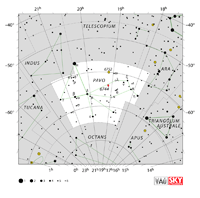
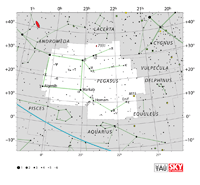
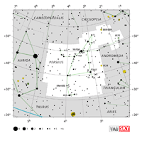
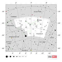
The Constellations | IAU

Over half of the 88 constellations the IAU recognizes today are attributed to ancient Greek, which consolidated the earlier works by the ancient Babylonian, Egyptian and Assyrian. Forty eight of the constellations we know were recorded in the seventh and eighth books of Claudius Ptolemy’s Almagest, although the exact origin of these constellations still remains uncertain. Ptolemy’s descriptions are probably strongly influenced by the work of Eudoxus of Knidos in around 350 BC. Between the 16th and 17th century AD, European astronomers and celestial cartographers added new constellations to the 48 previously described by Ptolemy; these new constellations were mainly “new discoveries” made by the Europeans who first explored the southern hemisphere. Those who made particular contributions to the “new” constellations include the Polish-born, German astronomer Johannes Hevelius; three Dutch cartographers, Frederick de Houtman, Pieter Dirksz Keyser and Gerard Mercator; the French astronomer Nicolas Louis de Lacaille; the Flemish mapmaker Petrus Plancius and the Italian navigator Amerigo Vespucci.

IAU and the 88 Constellations

Originally the constellations were defined informally by the shapes made by their star patterns, but, as the pace of celestial discoveries quickened in the early 20th century, astronomers decided it would be helpful to have an official set of constellation boundaries. One reason was to aid in the naming of new variable stars, which brighten and fade rather than shine steadily. Such stars are named for the constellation in which they reside, so it is important to agree where one constellation ends and the next begins.

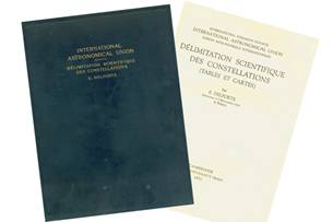
Eugène Delporte originally listed the 88 “modern” constellations on behalf of the IAU Commission 3 (Astronomical Notations), in Délimitation scientifique des constellations. (Delporte, 1930)


Constellation Figures

In star maps it is common to mark line “patterns” that represent the shapes that give the name to the constellations. However, the IAU defines a constellation by its boundary (indicated by sky coordinates) and not by its pattern and the same constellation may have several variants in its representation.

The constellations should be differentiated from asterisms. Asterisms are patterns or shapes of stars that are not related to the known constellations, but nonetheless are widely recognised by laypeople or in the amateur astronomy community. Examples of asterisms include the seven bright stars in Ursa Major known as “the Plough” in Europe or “the Big Dipper” in America, as well as “the Summer Triangle”, a large triangle, seen in the summer night sky in the northern hemisphere and composed of the bright stars Altair, Deneb and Vega. Whilst a grouping of stars may be officially designated a constellation by the IAU, this does not mean that the stars in that constellation are necessarily grouped together in space. Sometimes stars will be physically close to each other, like the Pleiades, but constellations are generally really a matter of perspective. They are simply our Earth-based interpretation of two dimensional star patterns on the sky made up of stars of many differing brightnesses and distances from Earth.


Constellation Names

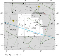
Each Latin constellation name has two forms: the nominative, for use when talking about the constellation itself, and the genitive, or possessive, which is used in star names. For instance, Hamal, the brightest star in the constellation Aries (nominative form), is also called Alpha Arietis (genitive form), meaning literally “the alpha of Aries”.

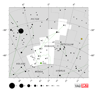
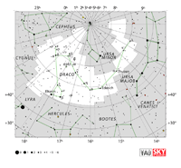
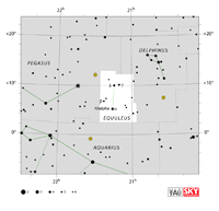
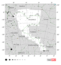
The Latin names of all the constellations, their abbreviated names and boundaries can be found in the table below. They are a mix of the ancient Greek patterns recorded by Ptolemy as well as some more “modern” patterns observed later by more modern astronomers.

The IAU adopted three-letter abbreviations of the constellation names at its inaugural General Assembly in Rome in 1922. So, for instance, Andromeda is abbreviated to And whilst Draco is abbreviated to Dra.

Charts and tables

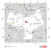
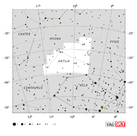
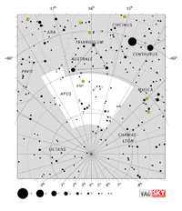
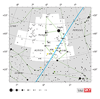
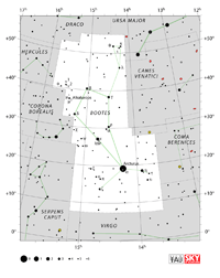
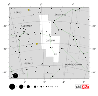
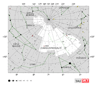
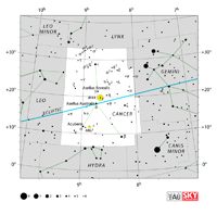
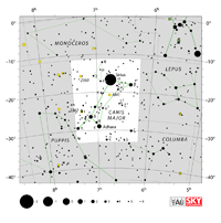
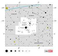
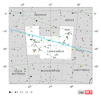
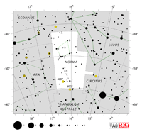
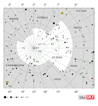
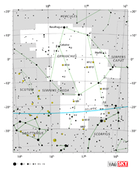
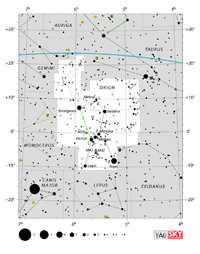
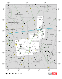
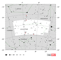
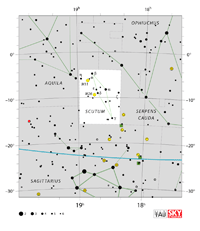
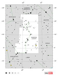
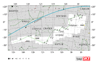
The charts below were produced in collaboration with Sky & Telescope magazine (Roger Sinnott & Rick Fienberg). Alan MacRobert’s constellation patterns, drawn in green in the charts, were influenced by those of H. A. Rey but in many cases were adjusted to preserve earlier traditions. The images are released under the Creative Commons Attribution 3.0 Unported license.

Quick links : And , Ant, Aps, Aqr, Aql, Ara, Ari, Aur, Boo, Cae, Cam, Cnc, CVn, CMa, CMi, Cap, Car, Cas, Cen, Cep, Cet, Cha, Cir, Col, Com, CrA, CrB, Crv, Crt, Cru, Cyg, Del, Dor, Dra, Equ, Eri, For, Gem, Gru, Her, Hor, Hya, Hyi, Ind, Lac, Leo, LMi, Lep, Lib, Lup, Lyn, Lyr, Men, Mic, Mon, Mus, Nor, Oct, Oph, Ori, Pav, Peg, Per, Phe, Pic, Psc, PsA, Pup, Pyx, Ret, Sge, Sgr, Sco, Scl, Sct, Ser, Sex, Tau, Tel, Tri, TrA, Tuc, UMa, UMi, Vel, Vir, Vol, Vul , Chart text legend

Charts Graphical Legend

Charts

Name /
Pronunciation
Abbr. English Name Genitive /
Pronunciation
Downloads
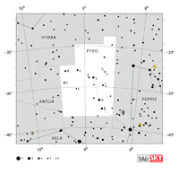
Andromeda

an-DRAH-mih-duh

And the Chained Maiden Andromedae
an-DRAH-mih-dee
Constellation charts
GIF (117 KB)
PDF (829 KB)
TIF

Constellation boundary
TXT (2 KB)

Antlia

ANT-lee-uh

Ant the Air Pump Antliae
ANT-lee-ee
Constellation charts
GIF (111 KB)
PDF (815 KB)
TIF

Constellation boundary
TXT (1 KB)

Apus
APE-us, APP-us
Aps the Bird of Paradise Apodis

APP-oh-diss

Constellation charts
GIF (155 KB)
PDF (836 KB)
TIF

Constellation boundary
TXT (1 KB)

Aquarius

uh-QUAIR-ee-us

Aqr the Water Bearer Aquarii

uh-QUAIR-ee-eye

Constellation charts
GIF (124 KB)
PDF (879 KB)
TIF

Constellation boundary
TXT (1 KB)

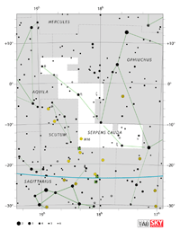
Aquila

ACK-will-uh, uh-QUILL-uh

Aql the Eagle Aquilae

ACK-will-ee, uh-QUILL-ee

Constellation charts
GIF (108 KB)
PDF (820KB)
TIF

Constellation boundary
TXT (1 KB)

Ara

AIR-uh, AR-uh

Ara the Altar Arae

AIR-ee, AR-ee

Constellation charts
GIF (114 KB)
PDF (807 KB)
TIF

Constellation boundary
TXT (1 KB)

Aries

AIR-eez, AIR-ee-yeez

Ari the Ram Arietis

uh-RYE-ih-tiss

Constellation charts
GIF (118 KB)
PDF (805 KB)
TIF

Constellation boundary
TXT (1 KB)

Auriga

aw-RYE-guh

Aur the Charioteer Aurigae

aw-RYE-ghee

Constellation charts
GIF (122 KB)
PDF (381 KB)
TIF

Constellation boundary
TXT (1 KB)

Boötes

bo-OH-teez

Boo the Herdsman Boötis

bo-OH-tiss

Constellation charts
GIF (147 KB)
PDF (823KB)
TIF

Constellation boundary
TXT (1 KB)

Caelum

SEE-lum

Cae the Engraving Tool Caeli

SEE-lye

Constellation charts
GIF (97 KB)
PDF (780 KB)
TIF

Constellation boundary
TXT (1 KB)

Camelopardalis

cuh-MEL-oh- PAR-duh-liss

Cam the Giraffe Camelopardalis

cuh-MEL-oh- PAR-duh-liss

Constellation charts
GIF (156 KB)
PDF (888 KB)
TIF

Constellation boundary
TXT (2 KB)

Cancer

CAN-ser

Cnc the Crab Cancri

CANG-cry

Constellation charts
GIF (108 KB)
PDF (814 KB)
TIF

Constellation boundary
TXT (1 KB)

Canes Venatici

CANE-eez (CAN-eez) ve-NAT-iss-eye

CVn the Hunting Dogs Canum Venaticorum

CANE-um (CAN-um) ve-nat-ih-COR-um

Constellation charts
GIF (106 KB)
PDF (790 KB)
TIF

Constellation boundary
TXT (1 KB)

Canis Major

CANE-iss (CAN-iss) MAY-jer

CMa the Great Dog Canis Majoris

CANE-iss (CAN-iss) muh-JOR-iss

Constellation charts
GIF (134 KB)
PDF (849 KB)
TIF

Constellation boundary
TXT (1 KB)

Canis Minor

CANE-iss (CAN-iss) MY-ner

CMi the Lesser Dog Canis Minoris

CANE-iss (CAN-iss) mih-NOR-iss

Constellation charts
GIF (83 KB)
PDF (766 KB)
TIF

Constellation boundary
TXT (1 KB)

Capricornus

CAP-rih-CORN-us

Cap the Sea Goat Capricorni

CAP-rih-CORN-eye

Constellation charts
GIF (98 KB)
PDF (818 KB)
TIF

Constellation boundary
TXT (1 KB)

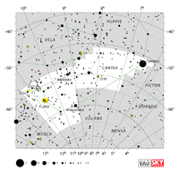
Carina

cuh-RYE-nuh, cuh-REE-nuh

Car the Keel Carinae

cuh-RYE-nee, cuh-REE-nee

Constellation charts
GIF (143 KB)
PDF (882 KB)
TIF

Constellation boundary
TXT (1 KB)

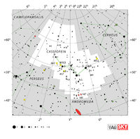
Cassiopeia

CASS-ee-uh-PEE-uh

Cas the Seated Queen Cassiopeiae

CASS-ee-uh-PEE-ye

Constellation charts
GIF (139 KB)
PDF (846 KB)
TIF

Constellation boundary
TXT (1 KB)

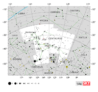
Centaurus Cen the Centaur Centauri Constellation charts
GIF (178 KB)
PDF (549 KB)
TIF

Constellation boundary
TXT (1 KB)

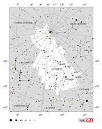
Cepheus Cep the King Cephei Constellation charts
GIF (200 KB)
PDF (873 KB)
TIF

Constellation boundary
TXT (2 KB)

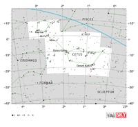
Cetus

SEE-tus

Cet the Sea Monster Ceti

SEE-tie

Constellation charts
GIF (122 KB)
PDF (873 KB)
TIF

Constellation boundary
TXT (1 KB)

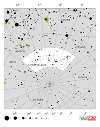
Chamaeleon

cuh-MEAL-yun, cuh-MEAL-ee-un

Cha the Chameleon Chamaeleontis

cuh-MEAL-ee-ON-tiss

Constellation charts
GIF (183 KB)
PDF (834 KB)
TIF

Constellation boundary
TXT (1 KB)

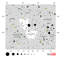
Circinus

SER-sin-us

Cir the Compass Circini

SER-sin-eye

Constellation charts
GIF (131 KB)
PDF (818 KB)
TIF

Constellation boundary
TXT (1 KB)

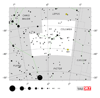
Columba

cuh-LUM-buh

Col the Dove Columbae

cuh-LUM-bee

Constellation charts
GIF (99 KB)
PDF (797 KB)
TIF

Constellation boundary
TXT (1 KB)

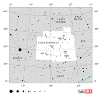
Coma Berenices

COE-muh BER-uh-NICE-eez

Com the Bernice’s Hair Comae Berenices

COE-mee BER-uh-NICE-eez

Constellation charts
GIF (101 KB)
PDF (788 KB)
TIF

Constellation boundary
TXT (1 KB)

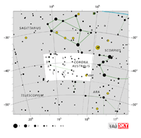
Corona Australis

cuh-ROE-nuh aw-STRAL-iss3

CrA the Southern Crown Coronae Australis

cuh-ROE-nee aw-STRAL-iss3

Constellation charts
GIF (107 KB)
PDF (787 KB)
TIF

Constellation boundary
TXT (1 KB)

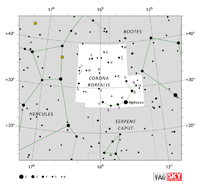
Corona Borealis

cuh-ROE-nuh bor-ee-AL-iss3

CrB the Northern Crown cuh-ROE-nee bor-ee-AL-iss3 Constellation charts
GIF (89 KB)
PDF (771 KB)
TIF

Constellation boundary
TXT (1 KB)

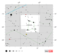
Corvus

COR-vus

Crv the Crow Corvi

COR-vye

Constellation charts
GIF (74 KB)
PDF (763 KB)
TIF

Constellation boundary
TXT (1 KB)

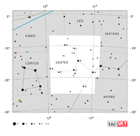
Crater

CRAY-ter

Crt the Cup Crateris

cruh-TEE-riss

Constellation charts
GIF (75 KB)
PDF (787 KB)
TIF

Constellation boundary
TXT (1 KB)

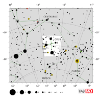
Crux

CRUCKS, CROOKS

Cru the Southern Cross Crucis

CROO-siss

Constellation charts
GIF (119 KB)
PDF (811 KB)
TIF

Constellation boundary
TXT (1 KB)

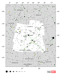
Cygnus

SIG- SIG-nu

Cyg the Swan Cygni

SIG-nye

Constellation charts
GIF (174 KB)
PDF (866 KB)
TIF

Constellation boundary
TXT (1 KB)

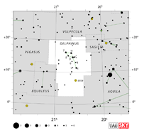
Delphinus

del-FINE-us, del-FIN-us

Del the Dolphin Delphini

del-FINE-eye, del-FIN-eye

Constellation charts
GIF (81 KB)
PDF (767 KB)
TIF

Constellation boundary
TXT (1 KB)

Dorado

duh-RAH-do

Dor the Swordfish Doradus

duh-RAH-dus

Constellation charts
GIF (108 KB)
PDF (795 KB)
TIF

Constellation boundary
TXT (1 KB)

Draco

DRAY-co

Dra the Dragon Draconis

druh-CONE-iss

Constellation charts
GIF (153 KB)
PDF (898 KB)
TIF

Constellation boundary
TXT (2 KB)

Equuleus

eh-QUOO-lee-us

Equ the Little Horse Equulei

eh-QUOO-lee-eye

Constellation charts
GIF (69 KB)
PDF (749 KB)
TIF

Constellation boundary
TXT (1 KB)

Eridanus

ih-RID-un-us

Eri the River Eridani

ih-RID-un-eye

Constellation charts
GIF (167 KB)
PDF (941 KB)
TIF

Constellation boundary
TXT (2 KB)

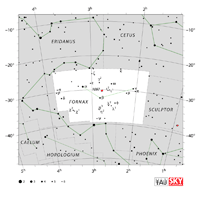
Fornax

FOR-naks

For the Furnace Fornacis

for-NAY-siss

Constellation charts
GIF (108 KB)
PDF (811 KB)
TIF

Constellation boundary
TXT (1 KB)

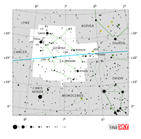
Gemini

JEM-uh-nye, JEM-uh-nee

Gem the Twins Geminorum

JEM-uh-NOR-um

Constellation charts
GIF (122 KB)
PDF (832 KB)
TIF

Constellation boundary
TXT (1 KB)

Grus

GRUSS, GROOS

Gru the Crane Gruis

GROO-iss

Constellation charts
GIF (127 KB)
PDF (829 KB)
TIF

Constellation boundary
TXT (1 KB)

Hercules

HER-kyuh-leez

Her the Hercules Herculis

HER-kyuh-liss

Constellation charts
GIF (156 KB)
PDF (829 KB)
TIF

Constellation boundary
TXT (1 KB)

Horologium

hor-uh-LOE-jee-um

Hor the Clock Horologii

hor-uh-LOE-jee-eye

Constellation charts
GIF (107 KB)
PDF (788 KB)
TIF

Constellation boundary
TXT (1 KB)

Hydra

HIGH-druh

Hya the Female Water Snake Hydrae

HIGH-dree

Constellation charts
GIF (127 KB)
PDF (929 KB)
TIF

Constellation boundary
TXT (2 KB)

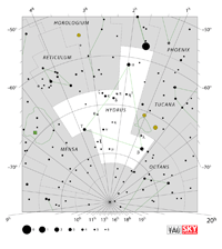
Hydrus

HIGH-drus

Hyi the Male Water Snake Hydri

HIGH-dry

Constellation charts
GIF (143 KB)
PDF (821 KB)
TIF

Constellation boundary
TXT (1 KB)

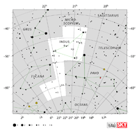
Indus

IN-dus

Ind the Indian Indi

IN-dye

Constellation charts
GIF (131 KB)
PDF (834 KB)
TIF

Constellation boundary
TXT (1 KB)

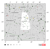
Lacerta

luh-SER-tuh

Lac the Lizard Lacertae

luh-SER-tee

Constellation charts
GIF (124 KB)
PDF (812 KB)
TIF

Constellation boundary
TXT (1 KB)

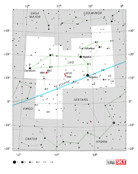
Leo

LEE-oh

Leo the Lion Leonis

lee-OH-niss

Constellation charts
GIF (142 KB)
PDF (820 KB)
TIF

Constellation boundary
TXT (1 KB)

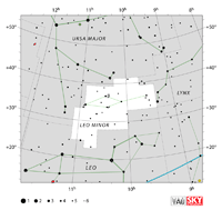
Leo Minor

LEE-oh MY-ner

LMi the Lesser Lion Leonis Minoris

lee-OH-niss mih-NOR-iss

Constellation charts
GIF (103 KB)
PDF (799 KB)
TIF

Constellation boundary
TXT (1 KB)

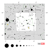
Lepus

LEEP-us, LEP-us

Lep the Hare Leporis

LEP-or-iss

Constellation charts
GIF (94 KB)
PDF (787 KB)
TIF

Constellation boundary
TXT (1 KB)

Libra

LEE-bruh, LYE-bruh

Lib the Scales Librae

LEE-bree, LYE-bree

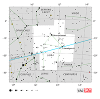
Constellation charts
GIF (111 KB)
PDF (819 KB)
TIF

Constellation boundary
TXT (1 KB)

Lupus

LOOP-us

Lup the Wolf Lupi

LOOP-eye

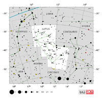
Constellation charts
GIF (137 KB)
PDF (857 KB)
TIF

Constellation boundary
TXT (1 KB)

Lynx

LINKS

Lyn the Lynx Lyncis

LIN-siss

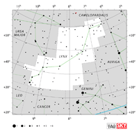
Constellation charts
GIF (111 KB)
PDF (796 KB)
TIF

Constellation boundary
TXT (1 KB)

Lyra

LYE-ruh

Lyr the Lyre Lyrae

LYE-ree

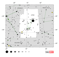
Constellation charts
GIF (91 KB)
PDF (776 KB)
TIF

Constellation boundary
TXT (1 KB)

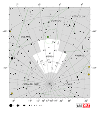
Mensa

MEN-suh

Men the Table Mountain Mensae

MEN-see

Constellation charts
GIF (161 KB)
PDF (827 KB)
TIF

Constellation boundary
TXT (1 KB)

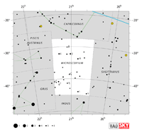
Microscopium

my-cruh-SCOPE-ee-um

Mic the Microscope Microscopii

my-cruh-SCOPE-ee-eye

Constellation charts
GIF (87 KB)
PDF (776 KB)
TIF

Constellation boundary
TXT (1 KB)

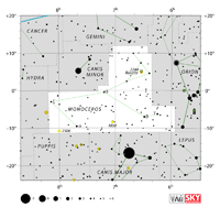
Monoceros

muh-NAH-ser-us

Mon the Unicorn Monocerotis

muh-NAH-ser-OH-tiss

Constellation charts
GIF (110 KB)
PDF (821 KB)
TIF

Constellation boundary
TXT (1 KB)

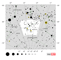
Musca

MUSS-cuh

Mus the Fly Muscae

MUSS-see, MUSS-kee

Constellation charts
GIF (134 KB)
PDF (828 KB)
TIF

Constellation boundary
TXT (1 KB)

Norma

NOR-muh

Nor the Carpenter’s Square Normae

NOR-mee

Constellation charts
GIF (118 KB)
PDF (803 KB)
TIF

Constellation boundary
TXT (1 KB)

Octans

OCK-tanz

Oct the Octant Octantis

ock-TAN-tiss

Constellation charts
GIF (140 KB)
PDF (821 KB)
TIF

Constellation boundary
TXT (1 KB)

Ophiuchus

OFF-ee-YOO-kus, OAF-ee-YOO-kus

Oph the Serpent Bearer Ophiuchi

OFF-ee-YOO-kye, OAF-ee-YOO-kye

Constellation charts
GIF (175 KB)
PDF (854 KB)
TIF

Constellation boundary
TXT (2 KB)

Orion

oh-RYE-un, uh-RYE-un

Ori the Hunter Orionis

or-eye-OH-niss

Constellation charts
GIF (181 KB)
PDF (873 KB)
TIF

Constellation boundary
TXT (1 KB)

Pavo

PAY-vo

Pav the Peacock Pavonis

puh-VOE-niss

Constellation charts
GIF (143 KB)
PDF (859 KB)
TIF

Constellation boundary
TXT (1 KB)

Pegasus

PEG-us-us

Peg the Winged Horse Pegasi

PEG-us-eye

Constellation charts
GIF (136 KB)
PDF (868 KB)
TIF

Constellation boundary
TXT (2 KB)

Perseus

PER-see-us, PER-syoos

Per the Hero Persei

PER-see-eye

Constellation charts
GIF (127 KB)
PDF (836 KB)
TIF

Constellation boundary
TXT (1 KB)

Phoenix

FEE-nix

Phe the Phoenix


Phoenicis

fuh-NICE-iss

Constellation charts
GIF (119 KB)
PDF (828 KB)
TIF

Constellation boundary
TXT (1 KB)

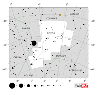
Pictor

PICK-ter

Pic the Painter’s Easel Pictoris

pick-TOR-iss

Constellation charts
GIF (108 KB)
PDF (794 KB)
TIF

Constellation boundary
TXT (1 KB)

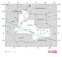
Pisces

PICE-eez, PISS-eez

Psc the Fishes Piscium

PICE-ee-um, PISH-ee-um

Constellation charts
GIF (87 KB)
PDF (859 KB)
TIF

Constellation boundary
TXT (1 KB)

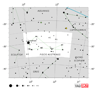
Piscis Austrinus

PICE-iss (PISS-iss) aw-STRY-nus

PsA the Southern Fish Piscis Austrini

PICE-iss (PISS-iss) aw-STRY-nye

Constellation charts
GIF (87 KB)
PDF (778 KB)
TIF

Constellation boundary
TXT (1 KB)

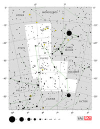
Puppis

PUP-iss

Pup the Stern Puppis

PUP-iss

Constellation charts
GIF (185 KB)
PDF (868 KB)
TIF

Constellation boundary
TXT (1 KB)

Pyxis

PIX-iss

Pyx the Compass Pyxidis

PIX-ih-diss

Constellation charts
GIF (84 KB)
PDF (775 KB)
TIF

Constellation boundary
TXT (1 KB)

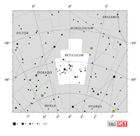
Reticulum

rih-TICK-yuh-lum

Ret the Reticle Reticuli

rih-TICK-yuh-lye

Constellation charts
GIF (107 KB)
PDF (786 KB)
TIF

Constellation boundary
TXT (1 KB)

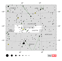
Sagitta

suh-JIT-uh

Sge the Arrow Sagittae

suh-JIT-ee

Constellation charts
GIF (90 KB)
PDF (773 KB)
TIF

Constellation boundary
TXT (1 KB)

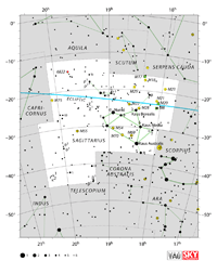
Sagittarius

SAJ-ih-TARE-ee-us

Sgr the Archer Sagittarii

SAJ-ih-TARE-ee-eye

Constellation charts
GIF (163 KB)
PDF (878 KB)
TIF

Constellation boundary
TXT (1 KB)

Scorpius

SCOR-pee-us

Sco the Scorpion Scorpii

SCOR-pee-eye

Constellation charts
GIF (194 KB)
PDF (874 KB)
TIF

Constellation boundary
TXT (1 KB)

Sculptor

SCULP-ter

Scl the Sculptor Sculptoris

sculp-TOR-iss

Constellation charts
GIF (119 KB)
PDF (810 KB)
TIF

Constellation boundary
TXT (1 KB)

Scutum

SCOOT-um, SCYOOT-um

Sct the Shield Scuti

SCOOT-eye, SCYOOT-eye

Constellation charts
GIF (120 KB)
PDF (784 KB)
TIF

Constellation boundary
TXT (1 KB)

Serpens

SER-punz

Ser the Serpent Serpentis

ser-PEN-tiss

Constellation charts (Serpens Caput)
GIF (112 KB)
PDF (780 KB)
TIF

Constellation boundary (Serpens Caput)
TXT (1 KB)

Constellation charts (Serpens Cauda)
GIF (126 KB)
PDF (791 KB)
TIF

Constellation boundary (Serpens Cauda)
TXT (1 KB)

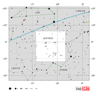
Sextans

SEX-tunz

Sex the Sextant Sextantis

sex-TAN-tiss

Constellation charts
GIF (83 KB)
PDF (782 KB)
TIF

Constellation boundary
TXT (1 KB)

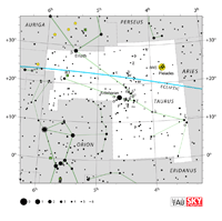
Taurus

TOR-us

Tau the Bull Tauri

TOR-eye

Constellation charts
GIF (115 KB)
PDF (832 KB)
TIF

Constellation boundary
TXT (1 KB)

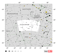
Telescopium Tel the Telescope Telescopii Constellation charts
GIF (148 KB)
PDF (834 KB)
TIF

Constellation boundary
TXT (1 KB)

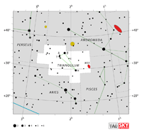
Triangulum

try-ANG-gyuh-lum

Tri the Triangle Trianguli

try-ANG-gyuh-lye

Constellation charts
GIF (89 KB)
PDF (764 KB)
TIF

Constellation boundary
TXT (1 KB)

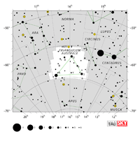
Triangulum Australe

try-ANG-gyuh-lum aw-STRAL-ee

TrA the Southern Triangle Trianguli Australis

try-ANG-gyuh-lye aw-STRAL-iss

Constellation charts
GIF (124 KB)
PDF (815 KB)
TIF

Constellation boundary
TXT (1 KB)

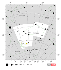
Tucana

too-KAY-nuh, too-KAH-nuh

Tuc the Toucan Tucanae

too-KAY-nee, too-KAH-nee

Constellation charts
GIF (127 KB)
PDF (806 KB)
TIF

Constellation boundary
TXT (1 KB)

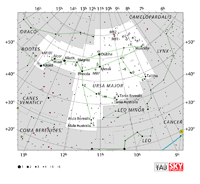
Ursa Major

ER-suh MAY-jur

UMa the Great Bear Ursae Majoris

ER-suh muh-JOR-iss

Constellation charts
GIF (174 KB)
PDF (885 KB)
TIF

Constellation boundary
TXT (1 KB)

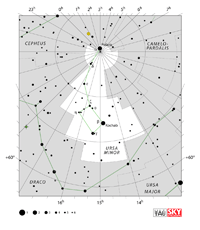
Ursa Minor

ER-suh MY-ner

UMi the Little Bear Ursae Minoris

ER-suh mih-NOR-iss

Constellation charts
GIF (135 KB)
PDF (800 KB)
TIF

Constellation boundary
TXT (1 KB)

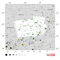
Vela

VEE-luh, VAY-luh

Vel the Sails Velorum

vee-LOR-um, vuh-LOR-um

Constellation charts
GIF (131 KB)
PDF (850 KB)
TIF

Constellation boundary
TXT (1 KB)

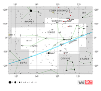
Virgo

VER-go

Vir the Maiden Virginis

VER-jin-iss

Constellation charts
GIF (98 KB)
PDF (831 KB)
TIF

Constellation boundary
TXT (1 KB)

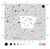
Volans

VOH-lanz

Vol the Flying Fish Volantis

vo-LAN-tiss

Constellation charts
GIF (123 KB)
PDF (812 KB)
TIF

Constellation boundary
TXT (1 KB)

Vulpecula

vul-PECK-yuh-luh

Vul the Fox Vulpeculae

vul-PECK-yuh-lee

Constellation charts
GIF (124 KB)
PDF (805 KB)
TIF

Constellation boundary
TXT (1 KB)


Charts Text Legend

Each constellation comes with the following basic information:
  1. Name
  2. Pronunciation of the name
  3. Abbreviation
  4. English Name
  5. Genitive
  6. Pronunciation of the genitive
  7. Chart for screen view (GIF)
  8. Chart for printing (PDF in A4 format)
  9. Boundary coordinates (TXT)
Explanation of the fields:

  1. The name is the Latin name adopted by the International Astronomical Union in 1930.
  2. Pronunciation as described above.
  3. Abbreviation, the standard three-letter form of the Latin name.
  4. The popular name in English.
  5. The genitive is the possessive form of the constellation’s name in Latin. For example, alpha Orionis is the alpha star in the constellation of Orion.
  6. Pronunciation as described above.
  7. Chart in GIF format, 1000 pixels wide.
  8. Chart in PDF format, to be printed in A4 format.
  9. A text file containing a set of coordinates that defines the boundaries of the constellations in the sky. The format is:
    HH MM SS.SSSS| DD.DDDDDDD|XXX

    Where:
    HH MM SS.SSSS defines the right ascension hour, minute and second with J2000 coordinates
    DD.DDDDDDD defines the declination with J2000 coordinates
    XXX is the abbreviation of the constellation name
    | is the separator of the fields

    Example:
    22 57 51.6729| 35.1682358|AND

Source: The Constellations | IAU

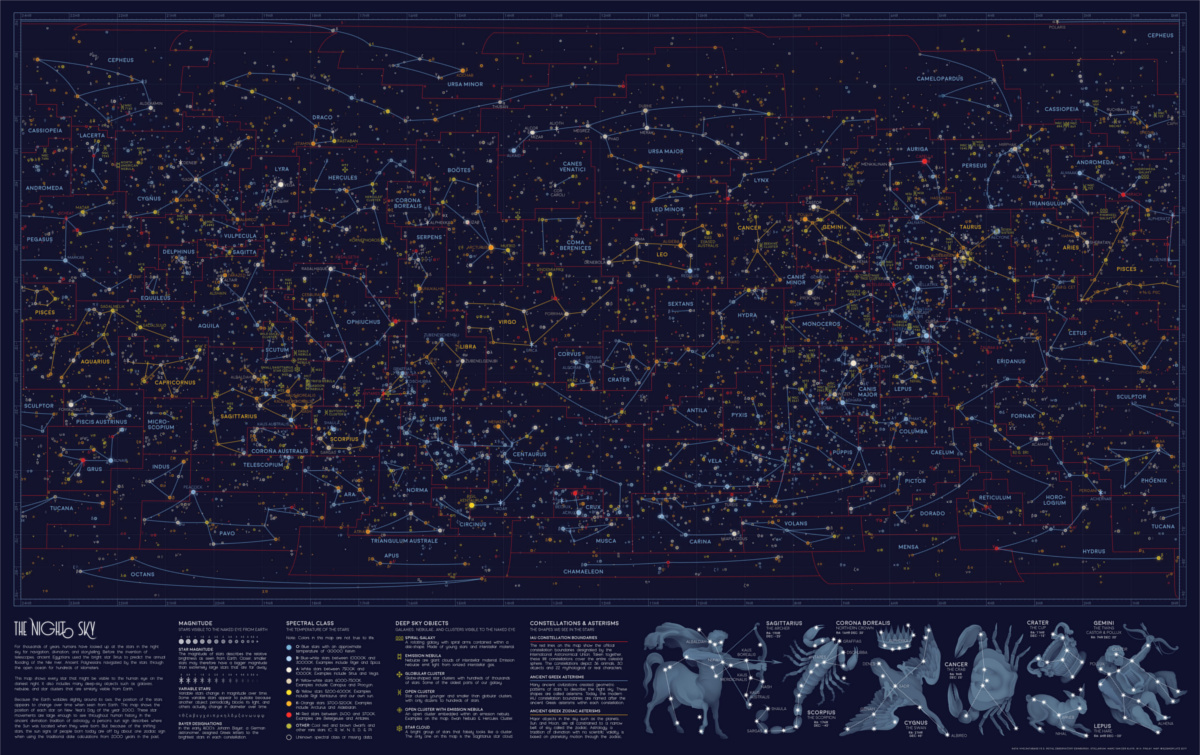
Every Visible Star in the Night Sky, in One Giant Map

Visible Stars in the Night Sky Map

Stars have served as a basis for navigation for thousands of years. Polaris, also dubbed the North Star in the Ursa Minor constellation, is arguably one of the most influential, even though it sits 434 light years away.

[…]

n the star map above, the orange lines denote the twelve signs of the Zodiac, each found roughly along the same band from 10° to -30° longitude. These Zodiac alignments, along with planetary movements, form the basis of astrology, which has been practiced across cultures to predict significant events. While the scientific method has widely demonstrated that astrology doesn’t hold much validity, many people still believe in it today.

The red lines on the visualization signify the constellations officially recognized by the International Astronomical Union (IAU) in 1922. Its ancient Greek origins are recorded on the same map as the blue lines, from which the modern constellation boundaries are based. Here’s a deeper dive into all 88 IAU constellations:

(Source: International Astronomical Union)

[…]

We now know that the night sky isn’t as static as people used to believe. Although it’s Earth’s major pole star today, Polaris was in fact off-kilter by roughly 8° a few thousand years ago. Our ancestors saw the twin northern pole stars, Kochab and Pherkad, where Polaris is now.

This difference is due to the Earth’s natural axial tilt. Eight degrees may not seem like much, but because of this angle, the constellations we gaze at today are the same, yet completely different from the ones our ancestors looked up at.

If you liked exploring this star map, be sure to check out the geology of Mars from the same designer.

Source: Every Visible Star in the Night Sky, in One Giant Map

Humans may be able to live on Mars within walls of aerogel – a wonder material that can trap heat and block radiation

We may be able to survive and live on Mars in regions protected by thin ceilings of silica aerogel, a strong lightweight material that insulates heat and blocks harmful ultraviolet radiation while weighing almost nothing.

Researchers at Harvard University in the US, NASA, and the University of Edinburgh in Scotland envision areas of Mars enclosed by two to three-centimetre-thick walls of silica aerogel. The strange material is ghost-like in appearance, and although it’s up to 99.98 per cent air, it’s actually a solid.

Aerogels come in various shapes and forms with their own mix of properties. Typically, they are made from sucking out the liquid in a gel using something called a supercritical dryer device. The resulting aerogel consists of pockets of air, and is therefore ultralight and can be capable of trapping heat. It can also be made hydrophobic or semi-porous as needed.

The semitransparent solid, therefore, has odd properties that may just help humans colonize the Red Planet. The solid silica can be manufactured to block out, say, dangerous UV rays while allowing visible light through.

However, it’s the trapping of heat that is most interesting here. When the boffins shone a lamp onto a thin block of silica aerogel, measuring less than 3cm thick, they found that the surface beneath the material warmed up to 65 degrees Celsius (that’s 150 degrees Fahrenheit for you Americans), high enough, of course, to melt ice into water. The results were published in Nature Astronomy on Monday.

Welcome to the Hotel Aerogel

The academics reckon if a region of ice near the higher latitudes of Mars was covered with a layer of aerogel, then the frosty ground would melt to produce liquid water as the environment heats up. It’d also be warm enough for humans to live and farm food in order to survive in the otherwise harsh, acrid conditions elsewhere the planet.

“The ideal place for a Martian outpost would have plentiful water and moderate temperatures,” said Laura Kerber, co-author of the paper and a geologist at NASA’s Jet Propulsion Laboratory. “Mars is warmer around the equator, but most of the water ice is located at higher latitudes. Building with silica aerogel would allow us to artificially create warm environments where there is already water ice available.”

Source: Humans may be able to live on Mars within walls of aerogel – a wonder material that can trap heat and block radiation • The Register

Scientists 3D-print human skin and bone for Mars astronauts

Scientists from the University Hospital of Dresden Technical University in Germany bio-printed skin and bone samples upside down to help determine if the method could be used in a low-gravity environment. It worked. ESA released videos of the printing in action.

The skin sample was printed using human blood plasma as a “bio ink.” The researchers added plant and algae-based materials to increase the viscosity so it wouldn’t just fly everywhere in low gravity.

“Producing the bone sample involved printing human stem cells with a similar bio-ink composition, with the addition of a calcium phosphate bone cement as a structure-supporting material, which is subsequently absorbed during the growth phase,” said Nieves Cubo, a bioprinting specialist at the university.

These samples are just the first steps for the ESA’s ambitious 3D bio-printing project, which is investigating what it would take to equip astronauts with medical and surgical facilities to help them survive and treat injuries on long spaceflights and on Mars.

“Carrying enough medical supplies for all possible eventualities would be impossible in the limited space and mass of a spacecraft,” said Tommaso Ghidini, head of ESA’s Structures, Mechanisms and Materials Division. “Instead, a 3D bioprinting capability will let them respond to medical emergencies as they arise.”

Source: Scientists 3D-print human skin and bone for Mars astronauts – CNET

Amazon Seeks Permission to Launch 3,236 Internet Satellites – awesome! more trash metal in low earth orbit!

Amazon wants the U.S. Federal Communications Commission (FCC) to give it the go-ahead to launch 3,236 satellites that would be used to establish a globe-spanning internet network. Seeking Alpha reported that Amazon expects “to offer service to tens of millions of underserved customers around the world” via the network, which the company is developing under the code-name Project Kuiper.

News of Project Kuiper broke in April, when Amazon uncharacteristically confirmed its work on the project to GeekWire. The company often declines to comment on reports concerning its plans; it seems the development of thousands of internet-providing satellites is the exception. The company had yet to seek FCC approval for the project, though, which is what Seeking Alpha reported today.

So what does this plan to offer space internet with a weird name actually involve? Amazon explained in April:

“Project Kuiper is a new initiative to launch a constellation of low Earth orbit satellites that will provide low-latency, high-speed broadband connectivity to unserved and underserved communities around the world. This is a long-term project that envisions serving tens of millions of people who lack basic access to broadband internet. We look forward to partnering on this initiative with companies that share this common vision.”

Expanding Internet access has become something of an obsession among tech companies. Google offers fiber Internet services as well as its own cellular network, Facebook scrapped plans to offer internet access via drones in June 2018, and Amazon isn’t the only company hoping to use low Earth orbit satellites to allow previously unconnected people to finally join the rest of the world online. It’s a bit of a trend.

Source: Amazon Seeks Permission to Launch 3,236 Internet Satellites

How to Track the LightSail 2 as It ‘Sails’ Around Earth

Last week, the LightSail 2 officially made its first contact with Earth. The solar-powered spacecraft will be sailing around Earth’s orbit for the next year, all part of a mission to prove that solar sailing is a viable mode of space exploration.

If successful, the hope is that solar sailing could be used in other spacecraft going forward, something that could allow us to explore further in space at a lower cost than is currently possible.

It’s a pretty cool idea and one that could ultimately have an impact on how we explore space in the future. And you can track it in real time from your computer whenever you want.

Now that the LightSail 2 is communicating with Earth, the folks from The Planetary Society that put the vessel in space are making some of its stats available through an online dashboard that’s free for anyone to look at.

Image: Planetary Society

With it, you can see things like how long the LightSail 2 has been on its mission, whether or not its sail is stowed, and what the internal temperature of the spacecraft is right now. You can also see where the vessel is right now and what path it’s expected to take, in case you want to try and snag a look as it passes overhead.

Image: Planetary Society

If you’re a space fan, it’s a pretty neat thing to check out, especially for that fly-by potential once the sail is deployed. And if that’s not enough, you can also track the LightSail 2’s progress in narrative form on The Planetary Society’s blog.

Source: How to Track the LightSail 2 as It ‘Sails’ Around Earth